Developers, start here
Start building indoor location-aware solutions today. Create a free developer account and you’ll automatically subscribe to a two month trial plan. No credit card needed.

Start building indoor location-aware solutions today. Create a free developer account and you’ll automatically subscribe to a two month trial plan. No credit card needed.
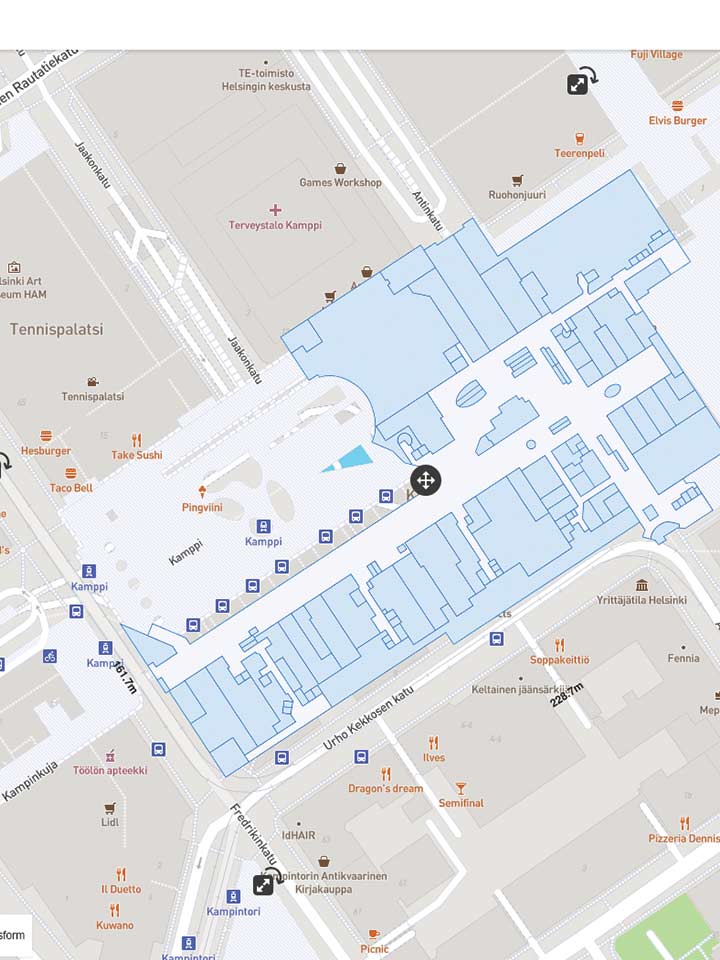
Set up your indoor space by creating a venue. Use the IndoorAtlas web tool to align your floor plan images to the world map. The floor plan images will be used to georeference the sensor data collected with a smartphone in the mapping phase. It is recommended to use images that match reality in sufficient detail – this will help you in the mapping phase. Make also sure that the floor plan images are accurately aligned with the world map.
IndoorAtlas web tool includes easy-to-use tools for creating wayfinding graphs, geofences, and POIs for your venue.
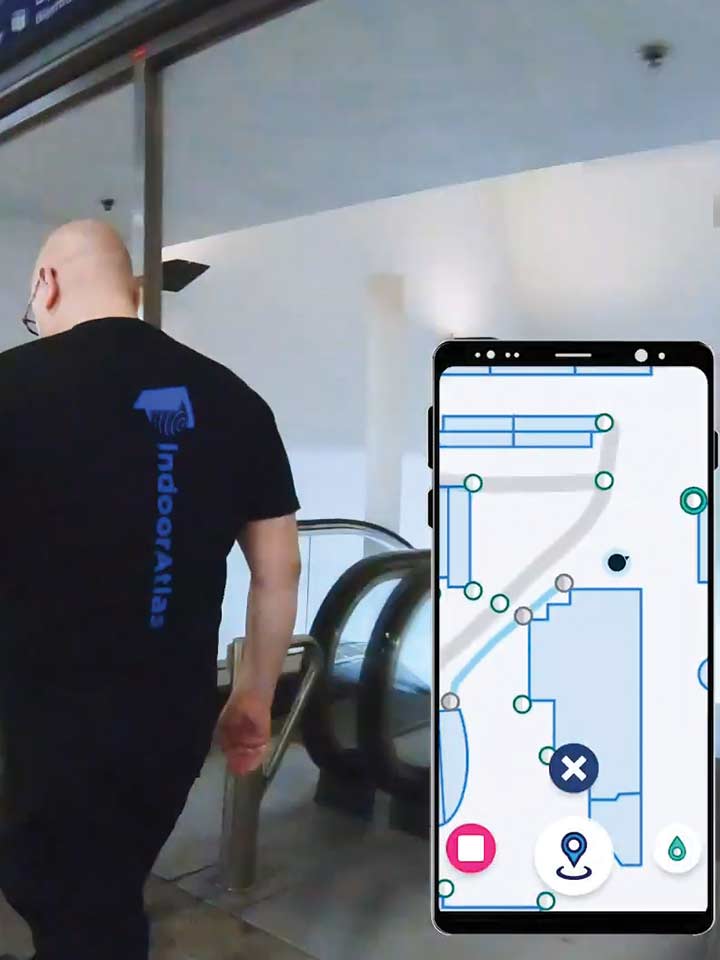
In the mapping phase, you’ll collect sensor data with your smartphone by physically walking around the venue. This requires you to install the IndoorAtlas MapCreator app for your Android smartphone. Before mapping, you should also ensure that the environment has sufficient beacon coverage – this is needed for end users using iOS devices. You can plan your beacon deployment with IndoorAtlas Beacon Planner that is part of our web tool suite. The beacon deployment plan will help you to have an idea about the number of beacons needed and their installation locations.
The data collected in the mapping phase is uploaded to the IndoorAtlas cloud. The final map is generated in the cloud to enable indoor positioning for your venue. You are now ready to start building your indoor location-aware app with IndoorAtlas SDK.
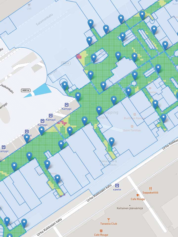
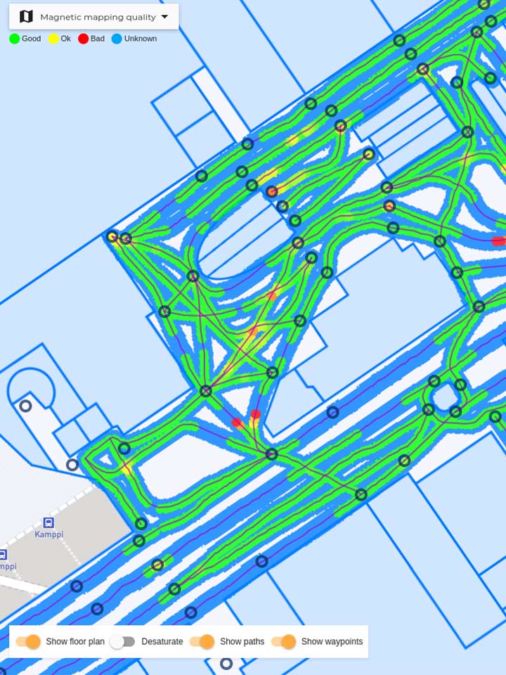
You should always validate your mapping quality. The mapping quality is the most important element affecting the end-user experience about the positioning performance. The mapping quality analytics view is available in both the IndoorAtlas web tool and the MapCreator app. IndoorAtlas MapCreator can also be used to test the performance of the indoor positioning service right after the mapping phase.
It is strongly recommended to use the MapCreator app’s diagnostics mode to collect test positioning sessions with ground truth paths. Ground truth paths represent the true, walked paths taken during the test session data collection. Use the Session Viewer to rerun and analyze collected test sessions by using sessions’ unique trace IDs. The Session Viewer is part of the IndoorAtlas web tool suite.
Use IndoorAtlas cross-platform SDK to build IndoorAtlas powered apps for Android, iOS, Unity, Cordovan, Xamarin, and React Native. To use the SDK you need first to create API keys in the IndoorAtlas web tool.
IndoorAtlas’ GitHub account has several code examples to speed up your app development. You can also use the IndoorAtlas demo app to quickly test out the IndoorAtlas location platform without coding. The demo app is available for Android and iOS devices in Google Play and App Store, respectively.
Get documentation and learn more about IndoorAtlas SDK, geolocation-aware AR, geofences, POIs, and use cases in our knowledge base.


 - (void)authenticateAndRequestLocation
  {
    // Create IALocationManager and point delegate to receiver
    self.manager = [IALocationManager sharedInstance];
    self.manager.delegate = self;

    // Set IndoorAtlas API key and secret
    [self.manager setApiKey:kAPIKey andSecret:kAPISecret];

   // Request location updates
   [self.manager startUpdatingLocation];
  }
manager = IALocationManager.create(this);
manager.requestLocationUpdates(IALocationRequest.create(), listener);
@Override
public void onLocationChanged(IALocation location) {
android.location.Location l = location.toLocation();
}IndoorAtlas REST APIs can be used to build new value-added features for your solution. The IndoorAtlas Positioning API enables on-demand radio-based positioning of devices that have an internet connection. IndoorAtlas Positioning API works without full-featured IndoorAtlas SDK and is particularly well suited for resource-limited platforms such as IoT devices.
IndoorAtlas Data API provides you access to the data generated from the positioning sessions. The data includes devices’ locations and part of the sensor inputs. The Data API can be used to build analytics and business intelligence solutions, for example. See an analytics demo code example at IndoorAtlas GitHub account.
IndoorAtlas GroundSage and IndoorAtlas Tracker solutions have been built on top of the Data API and the Positioning API, respectively.