IndoorAtlas Wayfinding
Built on the IndoorAtlas SDK, the wayfinding solution provides accurate and efficient navigation for complex venues such as airports, hospitals, shopping malls, and large office buildings.
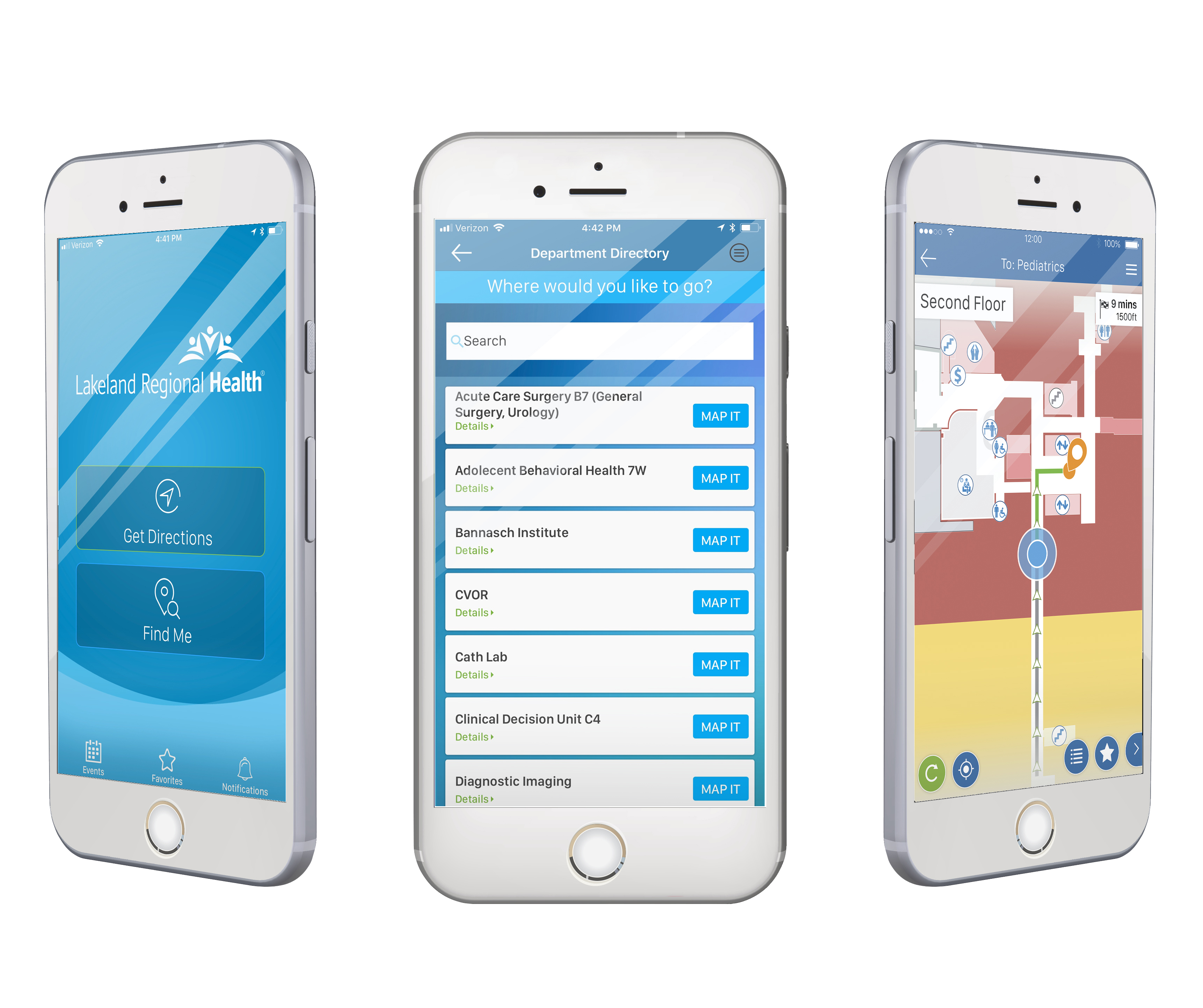
Built on the IndoorAtlas SDK, the wayfinding solution provides accurate and efficient navigation for complex venues such as airports, hospitals, shopping malls, and large office buildings.
Deploying IndoorAtlas Wayfinding is a straightforward process designed to ensure accurate and reliable indoor positioning and navigation. Use the web-based tool for venue setup, floor plan alignment, sensor data collection, deployment validation, and app development. Integrate wayfinding into your location-based service to enhance functionality and support new business opportunities.
Trial
Evaluate IndoorAtlas positioning technology at no cost with our self-serve trial
Free 30 days
Trial includes:
✓ Self-service support
✓ Single venue
✓ For non-production use
Develop Lite
Basic access for app developers exploring the IndoorAtlas platform
59€per month*
Develop Lite includes:
✓ Access to core platform features
✓ Single venue
✓ For non-production use
* Price excludes taxes. Applicable tax will be added at checkout.
Develop
Full-featured development plan including integration support and no feature or venue limitations
400€per month*
Develop includes:
✓ Access to all platform features
✓ Integration and technical support
✓ Suitable for multiple venues
✓ For non-production use
* Price excludes taxes. Applicable tax will be added at checkout.
Pro
For production deployments up to 10,000 m², with a streamlined feature set
349€per venue / month*
Pro includes:
✓ Designed for commercial use
✓ Defined feature scope
✓ Basic technical support
✓ No user limitations
✓ Pay by card
* Price excludes taxes. Applicable tax will be added at checkout.
Enterprise
Tailored for large-scale commercial deployments. Pricing varies based on volume, features, and support level
Enterprise includes:
✓ For commercial use across multiple venues
✓ Defined feature scope
✓ Service Level Agreement
✓ Volume-based pricing and discounts
✓ Technical support
* Price excludes taxes. Applicable tax will be added at checkout.
Let’s start building location-aware solutions together.